Количество страниц: 6 с.
This article contains data on the nature and level of study of the territories in which the north-eastern part of the Sakha Republic is located, which are potentially oil and gas bearing. In 1979-1992, seismic exploration of oil and gas was carried out in the Tastakh trough, the Zyryanka depression by JSC Yakutskgeofizika. The section of the Tastakh trough includes strata of terrigenous rocks of lithological unconstrained composition. Its capacity is 2.5-4.5 kilometers. The paper describes reflecting horizons based on Neogene-Quaternary, Jurassic-Cretaceous deposits. In addition, during the research, it was found that the Lower Cretaceous sediments present in the Tompon depression are divided by the Tomporuk-Kitchan zone of thrust divisions of the Late Cretaceous stage of activation of the Verkhoyano-Kolyma region. Upper Jurassic volcanogenic sedimentary rocks, Lower Cretaceous coal-bearing deposits are contained in the Zyryanka depression at 6 and 5 thousand meters, respectively. This article contains an opportunity for the allocation of time intervals, interpretation of sedimentary synchronous complexes of deflections, depressions, shelf. Seismic materials in these territories have a quality that can be recycled. The evidence of the need for this procedure appears during discussions on the topic of geological development, the structure of the mountain-folded Verkhoyano-Kolyma region, as well as the shelf that adjoins it. These data are confirmation of the presence of oil and gas in these territories. The work was carried out with the scientific equipment of the Center for Collective Use of the Federal research center ҺYakut Scientific Center of the Siberian Branch of the Russian Academy of Sciencesһ under grant No. 13.TsKP.21.0016. Support was received in the form of funds under the State Assignment from the Ministry of Science and Higher Education of the Russian Federation No. 122011100158-1.
Оболкин, А. П. Анализ сейсморазведочных исследований для оценки нефтегазоносности северо-востока Якутии / Оболкин А. П., Слепцова М. И., Севостьянова Р. Ф. ; Институт проблем нефти и газа // Успехи современного естествознания. - 2023. - N 12. - С. 193-198. - DOI: 0.17513/use.38191
DOI: 10.17513/use.38191
Количество страниц: 6 с.
The physical properties of air and water as carriers of thermal energy, used or taken into account in the development of devices and technologies for the use of natural thermal resources, are briefly stated. The developed cooling and heating devices and technologies that use the thermal energy of air and water are presented. It is shown how the change in the design achieved an increase in the reliability of the air thermosiphon used for local cooling of the soils of the foundations of structures. The technology of accumulating cold atmospheric air in an array of frozen soils containing underground structures, which has been successfully used for more than 10 years to control the temperature regime of the Federal Cryostorage of Plant Seeds in Yakutsk, in which only natural cold resources are used for the first time in the world, is given. The technology for creating an underground accumulator of cold atmospheric air by freezing water and using the heat of its phase transition to cool liquids and gases, as well as the results of experimental tests, are described. The efficiency of using the heat of the phase transition of water for heating some types of industrial premises is shown. A method for reducing the buoyant effect of frost heaving of soils on pile foundations by heating freezing heaving soils with the heat of the phase transition of water is described.
Кузьмин, Г. П. Устройства и технологии использования природных криогенных ресурсов / Кузьмин Г. П. ; Институт мерзлотоведения им. П. И. Мельникова // Успехи современного естествознания. - 2023. - N 9. - С. 71-76. - DOI: 10.17513/use.38105
DOI: 10.17513/use.38105
Количество страниц: 9 с.
The accuracy of GHCN-CAMS reanalysis reproduction of the intra-annual air temperature distribution was assessed for the historical (1961-1990) and current (1991-2020) climatic periods, on the scale of climatic norms of seasons and individual months. Data on 86 meteorological stations on the territory of the Sakha Republic (Yakutia), for which climatic series in both time periods were available, were used. The climatic norms of meteorological stations for both periods, as well as their change between periods, were compared with the GHCN- CAMS reanalysis data in corresponding pixels. The root mean square error, Pearson correlation coe cient, and Lin’s concordance coe cient were calculated as similarity metrics. Climatic norms for meteorological stations and calculated in the GHCN-CAMS reanalysis model are closely related linearly, with a correlation coe cient above 0.9, and the highest accuracy is observed for spring months. At the same time, the quality of reanalysis reconstruction of change in climatic norms for months and seasons between periods is signi cantly lower; the best reanalysis accuracy is for fall and winter, and signi cantly lower for summer. In general, the GHCN-CAMS model can be used for calculation and forecasting applications that require intra-annual air temperature distribution.
Тананаев, Н. И. Оценка точности реанализа GHCN-CAMS в расчетах внутригодового распределения температуры воздуха на территории Республики Саха (Якутия) / Н. И. Тананаев, М. А. Тимофеев ; Северо-Восточный федеральный университет им. М. К. Аммосова, Институт мерзлотоведения им. П. И. Мельникова // Вестник Северо-Восточного федерального университета им. М. К. Аммосова. Серия: Науки о земле. - 2023. - N 4 (32). - C. 99-110. - DOI: 10.25587/2587-8751-2023-4-99-110
DOI: 10.25587/2587-8751-2023-4-99-110
Количество страниц: 10 с.
Investigations over the last decades have shown that Yakutia is not only a highly representative area for the study of global climate patterns, it is a model of the Earth due to the extensive in uence of the Siberian anticyclone. Covering a grid of coordinates from the Arctic and Paci c Oceans almost to the Atlantic and Tibet, Yakutia dictates the patterns of climate change for the entire Northern Hemisphere. That can be clearly seen on example of modern climate change. The rate of warming here outpaces the rate of the Earth warming in 3-5 average annual degrees, thus showing not only the current warming trend, but also predicting it for the entire Earth with further temperature rise in future. Our paper shows the course of climate change over the last three centuries. It relies on the global patterns of atmospheric circulation on the wave of the hundred-year rhythm. Their essence is that the middle of centuries always brings cooling associated with latitudinal circulation of the atmosphere, and the turn of the century - the warming, in which latitudinal circulation is replaced by meridian circulation. It was happening in the last three centuries, con rmed by instrumental observations, and so it was in the time of Columbus and Vikings. Both came to America at the turn of the century 500 and 1000 years ago, when the Arctic Ocean and the North Atlantic were ice-free.
Поморцев, О. А. Якутия - модель глобального потепления климата земли (на примере циркуляции атмосферы) / О. А. Поморцев ; Северо-Восточный федеральный университет им. М. К. Аммосова // Вестник Северо-Восточного федерального университета им. М. К. Аммосова. Серия: Науки о земле. - 2023. - N 4 (32). - C. 69-78. - DOI: 10.25587/2587-8751-2023-4-69-78
DOI: 10.25587/2587-8751-2023-4-69-78
Количество страниц: 9 с.
- Математика. Естественные науки > Геология. Геологические и геофизические науки,
- Краеведение. Археология. География. Биографии. История > Общие вопросы. География как наука. Географические исследования,
- НАУКА ЯКУТИИ > МАТЕМАТИКА. ЕСТЕСТВЕННЫЕ НАУКИ > Геология. Геологические и геофизические науки,
- НАУКА ЯКУТИИ > КРАЕВЕДЕНИЕ. ГЕОГРАФИЯ. БИОГРАФИИ. ИСТОРИЯ > Общие вопросы. География как наука. Географические исследования.
Presently, the climate is warming, with average annual temperatures rising every year, and theArctic remaining one of the most vulnerable regions. This has a noticeable e ect on the northern forests, which leads to the displacement of the tundra zone. Assessing the consequences of a projected increase in air temperature under climate change conditions requires spatial and instant monitoring of hard-to-reach areas. In the last few years, the use of remote sensing techniques and combinations of satellite imagery to calculate vegetation indices has generated great interest in obtaining high-de nition ground data. The article presents the results of modeling soil moisture in Anabar tundra, which is located in the north-west of Yakutia. The study was conducted on the border of tundra and forest tundra in three reference areas (tundra, tundra young forest, tundra indigenous forest). The simulation is presented by comparing the eld data and the normalized di erence index of humidity NDMI. The NDMI index uses the NIR and SWIR channels, calculates a multi-channel raster object and creates a raster image with index values from -1 to 1, which show the humidity level with a spatial resolution of 10 meters. The data showed that the value of humidity pixels according to NDMI in the tundra zone is 0.04, in the tundra young forest is 0.09 and, in the tundra, native forest is 0.15. It was found that the index data correlated with eld humidity data obtained from a depth of 0.2 m. A comparison of remote sensing decryption data with eld data made it possible to simulate the spatial distribution of soil moisture over the vast study area by extrapolation.
Никифорова, Н. Н. Моделирование весовой влажности грунтов на территории Анабарской тундры с использованием наземных исследований и данных дистанционного зондирования земли / Н. Н. Никифорова, С. В. Калиничева, А. Н. Федоров ; Институт мерзлотоведения им. П. И. Мельникова // Вестник Северо-Восточного федерального университета им. М. К. Аммосова. Серия: Науки о земле. - 2023. - N 4 (32). - C. 60-68. - DOI: 10.25587/2587-8751-2023-4-60-68
DOI: 10.25587/2587-8751-2023-4-60-68
Количество страниц: 9 с.
The article considers the features of the petrographic composition of the lamprophyre dyke, attributed to the kHunkhadi complex of Late Cretaceous age, established on the Endegechchu hill in the Yano-Adycha tin ore region located in the Adycha tectonic zone. The rocks have a porphyry structure, and mineral formations of their own magmatic stage, magmatic, metasomatic and late hydrothermal-metasomatic substitutions are isolated in their composition. Acharacteristic feature of these rocks are spherulites of concentric-zonal structure, covered with a shell of scaly or lamellar graphite, depending on the size of the spherulites, evenly distributed throughout the rock, which were studied for the rst time and have not been established in other igneous rocks widely developed in the area. The study of spherulites is an important petrological task, which makes it possible to identify the mechanisms of their formation and causes, can indicate the conditions of formation and sources of matter of the rocks containing them. The morphology of graphite, its distribution and the nature of its relationship with surrounding minerals are also very informative for establishing the primary nature of graphite and epigenetic changes in host rocks as a result of various hydrothermal-metasomatic processes, which is possible due to the ability of carbonaceous matter to redistribute in the rock when exposed to various forces, rather than being removed from it.
Шепелева, Я. П. Петрография лампрофиров Ендегеччюйской площади Яна-Адычанского оловорудного района / Я. П. Шепелева, С. В. Горский ; Северо-Восточный федеральный университет им. М. К. Аммосова // Вестник Северо-Восточного федерального университета им. М. К. Аммосова. Серия: Науки о земле. - 2023. - N 4 (32). - C. 42-50. - DOI: 10.25587/2587-8751-2023-4-42-50
DOI: 10.25587/2587-8751-2023-4-42-50
Количество страниц: 9 с.
- Общественные науки. Образование > Народное образование. Воспитание. Обучение. Организация досуга > Высшее образование. Высшая школа. Подготовка научных кадров,
- Математика. Естественные науки > Геология. Геологические и геофизические науки,
- НАУКА ЯКУТИИ > ОБЩЕСТВЕННЫЕ НАУКИ > Народное образование. Воспитание. Обучение. Организация досуга > Высшее образование. Высшая школа. Подготовка научных кадров,
- НАУКА ЯКУТИИ > МАТЕМАТИКА. ЕСТЕСТВЕННЫЕ НАУКИ > Геология. Геологические и геофизические науки.
N the modern world, geology is one of the most important scienti c disciplines that can provide key knowledge about the structure and processes of our planet. Applied geology, in particular, requires high quali cations and practical experience, and eld training geological practices play a key role in the formation of not only theoretical knowledge of students but also of their practical skills. Educational geological practices permit students of the Faculty of Geology and Survey, North-Eastern Federal University, to master basic methods in eld geological research, including the analysis of rock formations, the identi cation of geological boundaries, and the recognizing of relief-faults. This article provides an overview of the structure and speci cs of eld training geological practices, involving multiple stages from preparatory to eldwork period. The article considers not only essence and signi cance of eld research in terms of formation practical geological skills but also analyze the key aspects that make these practices an integral part of the education of future geologists.
Третьякова, О. Г. Учебные геологические полигоны СВФУ - уникальные объекты для формирования общепрофессиональных компетенций в области геологии, поисков и разведки твердых полезных ископаемых / О. Г. Третьякова, Н. М. Третьякова ; Московская сельскохозяйственная академия им. К. А. Тимирязева, Северо-Восточный федеральный университет им. М. К. Аммосова // Вестник Северо-Восточного федерального университета им. М. К. Аммосова. Серия: Наука о земле. - 2023. - N 4 (32). - C. 33-41. - DOI: 10.25587/2587-8751-2023-4-33-41
DOI: 10.25587/2587-8751-2023-4-33-41
Количество страниц: 7 с.
The paper deals with the issue of regional gas content of Nejelinsky formation of the Lower Triassic. Based on the consideration of the peculiarities of the gas content of Nejelinsky formation and the upper productive horizons of the Permian age within the Khapchagai megawall, it is concluded that there are two types of deposits in the section of Nejelinsky formation. The rst type of deposits is gas-hydrodynamically limited in the volume of Nejelinsky formation and is genetically related to breakthrough gases from the Permian part of the section. The second type of deposits is gas-hydrodynamically related to deposits in the upper part of the Permian productive horizon. Due to the lack of its own gas formation potential in Nejelinsky formation outside the Khapchagai and Loglorsky shafts, it can only be considered as an e ective uid barrier. It is concluded that in the absence of isolated deposits in Nejelinsky formation, favorable reservoir properties in the Permian part of the section should be expected.
Сивцев, А. И. Природа газоносности неджелинской свиты / А. И. Сивцев, И. В. Рудых, Н. А. Сивцев ; Северо-Восточный федеральный университет им. М. К. Аммосова // Вестник Северо-Восточного федерального университета им. М. К. Аммосова. Серия: Науки о земле. - 2023. - N 4 (32). - C. 26-32. - DOI: 10.25587/2587-8751-2023-4-26-32
DOI: 10.25587/2587-8751-2023-4-26-32
Количество страниц: 6 с.
As a result of the research, a conclusion was made about the high prospects for the growth of gas reserves of Andylakhskoye gas condensate eld-located within the Loglor swell of the Vilyui syneclise of the Sakha Republic (Yakutia). An increase in reserves is expected, both due to previously discovered deposits and new, more promising horizons located in the Permian deposits. It is proposed to set up seismic surveys using the 2D common depth point method within the eld and the adjacent, most promising areas to increase investment attractiveness, the rational use of natural resources, and increasing gas reserves of Andylakhskoe gas condensate eld. According to the results of the studies carried out in this article, the prospects for the growth of hydrocarbon reserves of Andylakhskoe gas condensate eld are estimated by over 10 times of the amount.
Рудых, И. В. Прирост запасов углеводородов Андылахского газоконденсатного месторождения (Якутия) с учетом специфики его геологического строения / И. В. Рудых ; Северо-Восточный федеральный университет им. М. К. Аммосова, Геологоразведочный факультет // Вестник Северо-Восточного федерального университета им. М. К. Аммосова. Серия: Науки о земле. - 2023. - N 4 (32). - C. 20-25. - DOI: 10.25587/2587-8751-2023-4-20-25
DOI: 10.25587/2587-8751-2023-4-20-25
Количество страниц: 5 с.
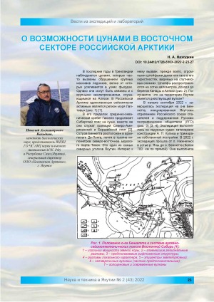
Находкин, Н. А. О возможности цунами в восточном секторе российской Арктики / Н. А. Находкин // Наука и техника в Якутии. - 2022. - N 2 (43). - С.23-27. - DOI: 10.24412/1728-516Х-2022-2-23-27
DOI: 10.24412/1728-516Х-2022-2-23-27
