Количество страниц: 8 с.
- Общий отдел > Информационные технологии. Вычислительная техника,
- Краеведение. Археология. География. Биографии. История > Общие вопросы. География как наука. Географические исследования,
- НАУКА ЯКУТИИ > КРАЕВЕДЕНИЕ. ГЕОГРАФИЯ. БИОГРАФИИ. ИСТОРИЯ > Общие вопросы. География как наука. Географические исследования,
- НАУКА ЯКУТИИ > ОБЩИЙ ОТДЕЛ > Информационные технологии. Вычислительная техника.
Currently, the absence of a GIS system linked to river basins in Russia may complicate the work of important operational environmental and hydrometeorological surveillance services. It is important to note that simplifying and accelerating the allocation of river basins through open source software can signi cantly optimize the work of researchers, especially in conditions where it is important to respond promptly to oods and oods in a short time. The purpose of this work is to automate the allocation of river catchment areas, which can help in the study of vast territories of the Far East, as well as contribute to the creation of effective forecasting and monitoring systems. The study presents an automated approach to the identi cation of watersheds based on the use of geospatial data and information processing algorithms. The presented method demonstrates the effective allocation of watershed boundaries, which makes it possible to simplify the research process and increase the accuracy of the data obtained. The study was conducted within the boundaries of Khangalassky district of the SR(Ya). The data obtained using digital terrain models were corrected, and then used for rapid allocation of watersheds by means of an algorithm developed by the authors. The algorithm is a module for QGIS, which uses the QGIS and GDAL tools in turn, which signi cantly speeds up the process of creating materials for further research. The results of the study emphasize the accessibility of obtaining information about the geosystems of river basins as integral systems and put forward the prospect of improving GIS processes related to water resources for more effective monitoring of ecosystems and decision-making in the eld of environmental protection.
Обутов, К. А. Автоматизация определения границ речных бассейнов малых рек на примере Хангаласского района РС (Я) / К. А. Обутов, Ю. Г. Данилов ; Северо-Восточный федеральный университет им. М. К. Аммосова // Вестник Северо-Восточного федерального университета им. М. К. Аммосова. - 2024. - N 2 (34). - C. 60-67. - DOI: 10.25587/2587-8751-2024-2-60-67
DOI: 10.25587/2587-8751-2024-2-60-67
Количество страниц: 7 с.
- Общий отдел > Общие вопросы науки и культуры,
- Математика. Естественные науки > Зоология,
- Краеведение. Археология. География. Биографии. История > Общие вопросы. География как наука. Географические исследования,
- НАУКА ЯКУТИИ > КРАЕВЕДЕНИЕ. ГЕОГРАФИЯ. БИОГРАФИИ. ИСТОРИЯ > Общие вопросы. География как наука. Географические исследования,
- НАУКА ЯКУТИИ > ОБЩИЙ ОТДЕЛ > Общие вопросы науки и культуры,
- НАУКА ЯКУТИИ > МАТЕМАТИКА. ЕСТЕСТВЕННЫЕ НАУКИ > Зоология.
The article is dedicated to the 170th anniversary of the Vilyuisk (Yakutia) expedition organised by the Siberian (Irkutsk) branch of the Imperial Russian Geographical Society (1853-1885). It was led by Richard Karlovich Maack (Germ. Richard Otto Maack), a Russian naturalist of German origin and explorer of Siberia and the Far East. It also contains some information on the Pribaikalia and Transbaikalia, taken along the way during the subsequent Amur (1855-1856) and Ussuri (1859-1960) expeditions. The route, dates, and composition of the expedition are described and the contribution of the scientist to various fields of natural science and, above all, to the study of vertebrates of the region is evaluated. Scientists have identified the habitat of amphibians and reptiles (4 species), birds (121), mammals (34), which is relatively large against the background of regional studies conducted in Eastern Siberia at that time. According to the lists of bird species published in the fundamental work of the scientist "Vilyuisky district of the Yakut region" [1883-1887], the distribution of 5 species of Gallinaceous birds (Gallinaceae) in the middle of the XIX century was revealed - Hazel Grouse, Western and Black-billied Capercaillies, Black Grouse, Willow Ptarmigan. For Transbaikalia and Pribaikalia, the habitat of two more species is noted - Gray and Bearded Partridges. The Common Pheasant was accounted for by R. K. Maack only in the Amur region and the Amur region (Far East). In general, over the century and a half of the history of studying Gallinaceous birds, their species composition has practically not changed in the researcher's work area. In Yakutia, it was replenished with species from the eastern and southern regions, living there Rock Partridge and Siberian Grouse. On the scale of Eastern Siberia, only the Pheasant is currently supplementing the Gallinaceous birds list as a new species in the region, documented in the south of Eastern Siberia - in the Eastern Sayan bordering the Baikal region and in some places of Transbaikalia (not yet precisely confirmed).
Елаев, Э. Н. Вилюйская экспедиция Ричарда Маака в изучении орнитофауны и куриных птиц (Gallinaceae) Восточной Сибири / Э. Н. Елаев, А. П. Исаев ; Бурятский государственный университет им. Д. Банзарова, Институт биологических проблем криолитозоны СО РАН // Вестник Северо-Восточного федерального университета им. М. К. Аммосова. - 2024. - Т. 21, N 2 (96). - С. 14-20. - DOI: 10.25587/2222-5404-2024-21-2-14-20
DOI: 10.25587/2222-5404-2024-21-2-14-20
Количество страниц: 13 с.
In this article we present the results of landscape structure study in the Middle Lena valley (Erkeni, Ensieli and Tuimaada), made using GIS mapping based on Sentinel 2 satellite images andASTER GDEM datasets. Alas complexes and croplands were identi ed using K-means image segmentation with di erent initial numbers. Three machine learning algorithms were tested for pixel-based land cover classi cation. The best result was achieved with the Support Vector Machine classi er. The mapping revealed the landscape structure of 20 spatial units, which were organized into groups of upland, alas, slope, valley and oodplain landscapes. The contrasting landscape structure of the Middle Lena valley was revealed. The northern Ensieli valley is characterized by the predominance of forest larch-pine landscapes, alas complexes mostly dry with steppe meadows are widespread in the watershed. The slopes are dominated by larch forests with patches of birch. The central Tuimaada valley is the most anthropogenically transformed, here steppe meadows and anthropogenic steppes dominate. The plateau part is mainly forested with croplands. The southern valley of the Erkeni is characterized by the smallest area of the valley part dominated by steppe meadows, the slopes of the main bank of the southern and south-eastern exposition are covered with xerophytic meadows. The landscape structure of valleys, oodplain and plakor parts largely determines the speci cs of agricultural land use of the local population. The results obtained can be used for further research into the response of permafrost landscapes of the Middle Lena valleys to increased anthropogenic pressure in the context of climate change.
Ландшафтная структура долины Средней Лены / М. И. Захаров, М. М. Черосов, С. Гадаль [и др.] ; Северо-Восточный федеральный университет им. М. К. Аммосова, Якутский научно-исследовательский институт сельского хозяйства, Университет Экс-Марсель, Институт биологических проблем криолитозоны // Вестник Северо-Восточного федерального университета им. М. К. Аммосова. Серия "Науки о Земле". - 2024. - N 1 (33). - C. 75-87. - DOI: 10.25587/2587-8751-2024-1-75-87
DOI: 10.25587/2587-8751-2024-1-75-87
Ответственность: Иванова Светлана Алексеевна (Научный руководитель)
Количество страниц: 4 с.
- Общественные науки. Образование > Народное образование. Воспитание. Обучение. Организация досуга > Организация досуга,
- Краеведение. Археология. География. Биографии. История > Общие вопросы. География как наука. Географические исследования,
- НАУКА ЯКУТИИ > ОБЩЕСТВЕННЫЕ НАУКИ > Народное образование. Воспитание. Обучение. Организация досуга.
Кулаковский, П. П. Проектирование туристско-рекреационных зон Верхоянского хребта (на примере бассейна реки Белянка) / Кулаковский П. П. ; научный руководитель Иванова С. А. ; Северо-Восточный федеральный университет им. М. К. Аммосова, Институт естественных наук // Республиканская молодежная научно-практическая конференция, посвященная празднованию 150-летия со дня рождения В. К. Арсеньева, Якутск, 19 октября 2022 г. : сборник научных трудов / [редакционная коллегия: Ю. Г. Данилов, Ж. Ф. Дегтева, С. А. Иванова и др.]. - Якутск : Издательский дом СВФУ, 2023. - 1 файл (85 с. ; 2,5 Мб). - С. 58-61.
Количество страниц: 4 с.
- Общественные науки. Образование > Народное образование. Воспитание. Обучение. Организация досуга > Общеобразовательная школа. Дошкольные учреждения,
- Краеведение. Археология. География. Биографии. История > Общие вопросы. География как наука. Географические исследования,
- НАУКА ЯКУТИИ > ОБЩЕСТВЕННЫЕ НАУКИ > Народное образование. Воспитание. Обучение. Организация досуга > Общеобразовательная школа. Дошкольные учреждения,
- НАУКА ЯКУТИИ > КРАЕВЕДЕНИЕ. ГЕОГРАФИЯ. БИОГРАФИИ. ИСТОРИЯ > Историческая наука. Историография.
Андреева, А. В. Методические условия развития познавательной активности учащихся на основе использования космических снимков (на примере курса "География Якутии") / А. В. Андреева ; Северо-Восточный федеральный университет им. М. К. Аммосова // XXV Лаврентьевские чтения, посвященные 30-летию Академии наук РС (Я) : материалы научной конференции студентов, аспирантов и молодых ученых, Якутск, 10-13 апреля 2023 г. / [редакционная коллегия: И. Е. Егоров, Н. П. Лазарев]. - Якутск : Издательский дом СВФУ, 2023. - 1 файл (275 с. ; 24,0 Мб). - С. 118-121.
Количество страниц: 8 с.
- Общий отдел > Общие вопросы науки и культуры,
- Краеведение. Археология. География. Биографии. История > Общие вопросы. География как наука. Географические исследования,
- НАУКА ЯКУТИИ > ОБЩИЙ ОТДЕЛ > Общие вопросы науки и культуры,
- НАУКА ЯКУТИИ > КРАЕВЕДЕНИЕ. ГЕОГРАФИЯ. БИОГРАФИИ. ИСТОРИЯ > Общие вопросы. География как наука. Географические исследования.
Ширина, Д. А. Отечественная академия наук и Якутская комплексная экспедиция=National academy of sciences and the Yakut complex expedition / Д. А. Ширина // Академические исследования в Якутии: "территория историка" : сборник статей, посвященных юбилею профессора Д. А. Шириной. – Якутск : Алаас, 2016. – С. 144-150.
Количество страниц: 8 с.
- Общий отдел > Общие вопросы науки и культуры,
- Краеведение. Археология. География. Биографии. История > Общие вопросы. География как наука. Географические исследования,
- НАУКА ЯКУТИИ > КРАЕВЕДЕНИЕ. ГЕОГРАФИЯ. БИОГРАФИИ. ИСТОРИЯ > Общие вопросы. География как наука. Географические исследования,
- НАУКА ЯКУТИИ > ОБЩИЙ ОТДЕЛ > Общие вопросы науки и культуры.
Ширина, Д. А. К вопросу о деятельности Русского географического общества в Якутии: экспедиция Р. К. Маака=To the question of the activities of the Russian geographical society in Yakutia: R. K. Maak's expedition / Д. А. Ширина // Академические исследования в Якутии: "территория историка" : сборник статей, посвященных юбилею профессора Д. А. Шириной. – Якутск : Алаас, 2016. – С. 150-157.
Количество страниц: 6 с.
- Краеведение. Археология. География. Биографии. История > Общие вопросы. География как наука. Географические исследования,
- Математика. Естественные науки > Природа. Охрана окружающей среды,
- НАУКА ЯКУТИИ > МАТЕМАТИКА. ЕСТЕСТВЕННЫЕ НАУКИ > Природа. Охрана окружающей среды,
- НАУКА ЯКУТИИ > КРАЕВЕДЕНИЕ. ГЕОГРАФИЯ. БИОГРАФИИ. ИСТОРИЯ > Общие вопросы. География как наука. Географические исследования.
The article considers approaches to evaluation of transformation of landscapes, the analysis of the modern structure of landscapes and their transformation near the settlement Batagay.
Горохов, А. Н. Степень преобразованности ландшафтов Северо-Восточной Якутии / А. Н. Горохов, кандидат биологических наук ; НИИ прикладной экологии Севера ФГАОУ ВО "Северо-Восточный федеральный университет им. М. К. Аммосова" // Вторая Якутская комплексная экспедиция: начало пути : сборник материалов республиканской научно-практической конференции. – Якутск : Издательский центр СВФУ, 2017. – С. 203-208.
Количество страниц: 10 с.
Conception of the national-regional component is directed to humane, social and active paradigms of education. Scientific methods of its realization at secondary schools revealed: a.ecolozation of educational institution institutions (setting up ecologically oriented schools, in which the whole pedagogical system in connected with ecological aspects); b.system of geo-ecological study of local lore including all the children, as far as possible. It can be realized by compulsory or optional education.
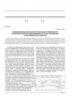
Кривошапкина, О. М. Концепция национально-регионального компонента геоэкологического образования и пути ее реализации в Республике Саха (Якутия)=Conception of the national-regional component of geo-ecological education and its realization in the Republic of Sakha (Yakutia) / О. М. Кривошапкина // Вестник Якутского государственного университета им. М. К. Аммосова. – 2005. – Т. 2, N 2. – С. 95-104.
Издательство: Нерюнгринская централизованная библиотечная система
Год выпуска: 2014
Количество страниц: 41 с.


